


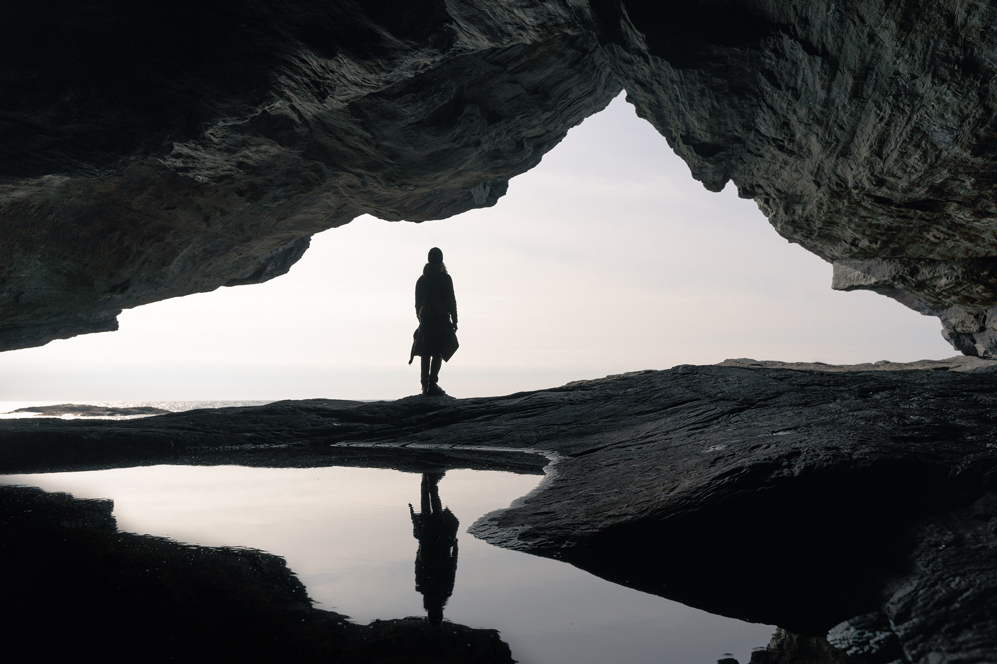
Bekhilderen. A cave at Telavåg. Sitting quite close to the waterline. It is essential to plan the visit, because the level of the sea will hinder you to access the cave.
There isn´t a determined parking area for Bekhilderen. Along the main road, you can park you car on roadside ditch. As long it will not interfere with traffic. It that is not optional, park at Telavåg football field parking lot, or the road that leads to it.
Parking closer to where the path starts is not optional, as the road is proprietary for the people whom live there.
Before Telavåg football field, there is a road that goes to the left (coming from South). Start walking down that a bit. Take the first longer appendix road to left. This can be seen on Google Maps quite easily, as you are making your way south to Bekhilderen. You can also see the gravel road that leads to a small building at the end of it. That is where you will encounter your first sign.
There are two paths at the end of the gravel road. Both of them is correct. The right leads to an old grinder, which you can start (I have heard). You can make yourself to the main path easy from there.
An important part of the hike is to get lower towards sea level. That is done by some flight of stairs you will encounter quite earily.

The tarrain is easy enough to walk on. Just keep an eye out on where the path is, while you make yourself to the South- by South West.
Eventually you will come to a sign that says Bekhilderen.

When you have made it to the sign, you are now walking straight towards the sea. It can be slippy at some places, due to mud.

The red mailbox is where you can write your name into a visiting log- book. There is around 5 more more minutes of walking before you come to the cave. Twenty meters passed this mailbox, is a massive, weird looking stone which appears to have a path on it. There is also markings to confirm it to be the correct way to go.
After passing the rock, make yourself towards the stone wall at the end. Right beneath it, is the cave.


The rich text element allows you to create and format headings, paragraphs, blockquotes, images, and video all in one place instead of having to add and format them individually. Just double-click and easily create content.

A rich text element can be used with static or dynamic content. For static content, just drop it into any page and begin editing. For dynamic content, add a rich text field to any collection and then connect a rich text element to that field in the settings panel. Voila!
Headings, paragraphs, blockquotes, figures, images, and figure captions can all be styled after a class is added to the rich text element using the "When inside of" nested selector system.


